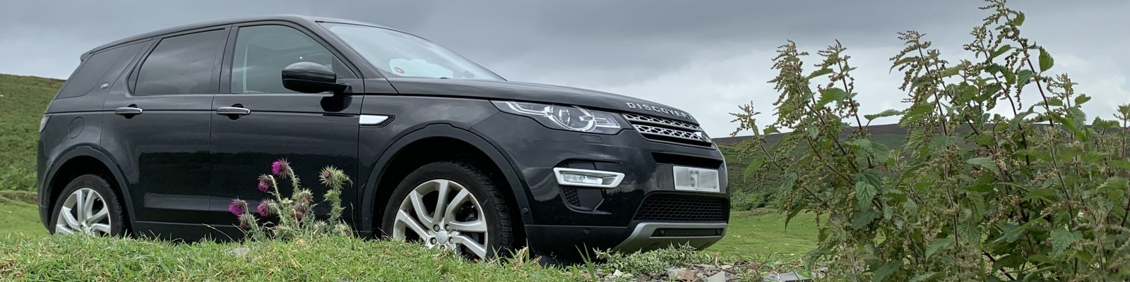
 Sat Nav’s are all well and good, but they only get you to where you are going. To be a true adventurer you need maps, and lots of them. Luckily, living in England, we have access to the Ordnance Survey maps, which are all awesome. These come in a variety of scales and allow you to find the cool places to visit, which (if you have to) you can then navigate to with your Sat Nav. You could be really daring and ditch the technology and navigate by paper maps and signposts!
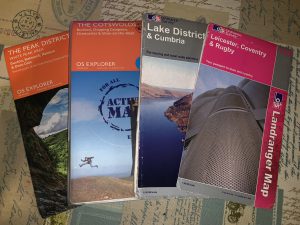
The ‘Landranger’ series are in 1:50,000 scale (2cm to 1 km, or 1 and a quarter inches to 1 mile). These are what I first used to learn how to read maps, and the earliest one we have is a Seventh series map of Northampton, map number 133, from 1961, where the scale was one inch to one Statute Mile. Our current Leicestershire map in number 140, revision C2, from 2006. We will need to update this soon, as unfortunately the landscape of our county is changing daily, and not always for the better!
The next set of maps we use, and the ones we use the most, are the ‘OS Explorer’ range. They are in 1:25,000 scale (4 cm to 1 km, or 2 and a half inches to 1 mile). Better detail and double sided. Some are available in an ‘Active Map’ version, which is laminated and waterproof. Ideal for the UK! Most of ours are from 2015, although one is from last year. All of these new ones currently come with a Mobile Download code, which is hidden under a scratch off panel.You can download the OS app and then download a digital version of your map, should you wish to. We actually subscribe to the app as well for around £20 per year (as of 2020). Its still nice to lay a paper map our over a car bonnet, and search around for somewhere interesting to go.
We also have one of the ‘Travel Map’ series, which are in 1:110,00 scale (1 cm to 1 km, 1 inch to 1 and three quarter miles). This one is called ‘Tour 3’ and is for the Lake District & Cumbria. We got it in 2007 when travelling back fromScotland. Its not great on intricate detail but very handy for locating where you are and where you need to be. Very good for tourists and the casual traveler.
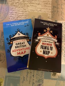
The final set of maps we have are relatively new. Available from marvellousmaps.com, they come in a variety of flavours. We have the ‘Great British Adventure Map’ and the ‘Great British Film & TV Map’. These double-sided maps are not your conventional sort. They are just a big map of the British Isles, with points of interest dotted all over them. An excellent idea, and one we were keen to devour had it not been for some sort of pandemic that set in not too long after we acquired them. We are very eager to visit some, as all would be a stretch, of the suggested locations. My personal favourite is the Film & TV map. We will report back on the enjoyment factor of these once we have a few locations under our belts. Keep an eye out for a Film & TV location gallery!
And finally – if you want a brilliant book to teach your kids how to map read, look no further than the Ladybird Book of ‘Understanding Maps’. Published in the 1960’s, it is now out of print but available on Ebay and second hand book stores on Amazon (and, I would imagine, on many other shops online). I had one as a kid, and managed to get my daughter one online. Original price – 24 pence! Probably set you back a few pounds now.
Posted 21st November 2019. Updated Jan 2021.