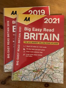
 I have had many large format road map books over the many years I have been driving. There is a pile of them collecting in the garage. I seem to have settled on the AA ‘Big Easy Read Britain’ for the last few years. I try not to update them too often, but there has been a lot of roadworks activity during the Covid lock-down, with many councils and companies taking advantage of the quiet(er) roads, so I took the plunge and got the 2021 version.
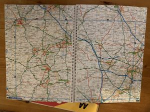
The book itself is spiral bound and measures 390 mm x 285 mm (15.4 inch x 11.2 inch), with 208 pages. The map scale is 2.5 miles to 1 inch, which provides a very easy to read map. They pack in a lot of other information, two pieces of which are of great use to us: National Trust property locations and Service Stations.
There are also 72 detailed city, town and port plans, as well as a detailed London district map. Other useful information is there describing Smart Motorways, and traffic signs.
Although we have a Sat Nav, we use these a lot to find where we want to go to, and occasionally to find out where we are! Especially useful when going old school and just navigating by Signpost, or playing the Left/Right game (where someone just shouts out Left or Right at a junction randomly until we end up somewhere interesting!). This is one of the most essential things you can keep in any vehicle – never leave home without one!